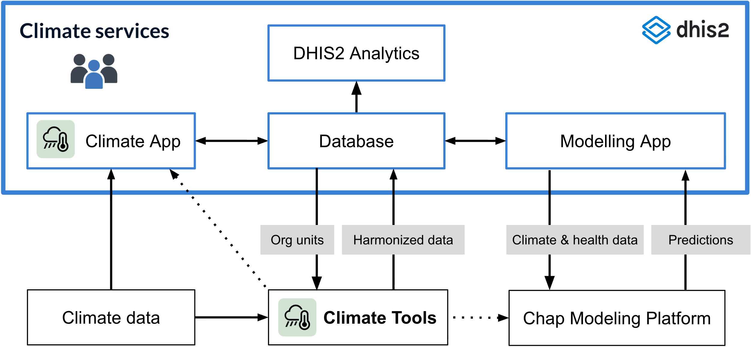
DHIS2 Climate Tools is an open, collaborative toolkit for building climate, weather, and environmental data workflows with DHIS2. The toolkit provides implementers with a flexible workspace that includes a curated Python environment, practical how-to guides, and end-to-end workflows for accessing, processing, and uploading climate, weather, and environmental data to DHIS2 and the Chap Modeling Platform.
The toolkit is based on the Python programming language and ecosystem. Python is the leading programming language for geospatial analysis, offering a rich ecosystem of libraries and tools that DHIS2 Climate Tools builds on. This makes complex spatial operations accessible to both beginners and advanced users.
The DHIS2 Climate Tools guidebook has two primary users:
Data engineer: Integrate climate and environmental data from different sources, aggregating data to country regions (organisation units) to align it with health data and import the result into DHIS2.
Data scientist: Analyse and visualize climate data using tools and techniques that are not available in DHIS2. It will allow you to work on raw data that contains more detail than data aggregated to organisation units.
DHIS2 Climate Tools is part of the DHIS2 for Climate & Health project which aims to break climate and health data out of silos to facilitate combined analysis and forecasting, and strengthen climate-resilient health systems. The guidebook is maintained and operated by the global HISP network to support the needs in the countries. We also welcome contributions from the community.
We also provide the DHIS2 Climate App which allows you to explore a wide range of weather, climate and environmental data for your organisation units, and to import weather and climate data into DHIS2, which can then be analyzed and visualized in combination with health data - without writing any code.